
- This event has passed.
Hill Walk Camaderry
September 6, 2020
![]()
Walk: Camaderry Mountain, Co. Wicklow.
Meeting Point: Upper Lake car park, Glendalough (Grid ref: T 111 964).
Meeting Time: 9.30 am. Driving time Skerries to Glendalough: 1 hr 30 mins approx.
Walk Start Time: 9.45 am from Upper Lake car park.
Route: Upper Lake car park – Miners’ Village – Glenealo Valley – Turlough Hill Reservoir – Camaderry – Camaderry East – Upper Lake car park.
Distance: 15 km (approx)
Height: Summit 698 m; Total ascent: 625 m approx.
Duration: approx. 5.5 hours (including breaks)
Please text or email the leader by Friday 4th Sept if you intend going on the walk, including your mobile number.
THIS IS A HILLWALK
1) Please ensure that, at the very least, you have waterproof hiking boots and, depending on the weather forecast, multiple layers including a warm jacket/fleece, hat and gloves, a waterproof jacket and trousers, sandwiches/snacks, a litre of water and a rucksack. Gaiters would also be useful for this walk, as would hiking poles if you normally use them. If you are unsure about your gear check with leader a few days beforehand as anyone turning up with inadequate gear will not be permitted to walk.
2) It is highly recommended that you do not wear any clothing made from denim/corduroy/cotton on the walk.
3) The club is a supporter of the ‘Leave No Trace’ campaign, so please ensure that you leave no litter (of any sort) on the walk route.

Before the walk you will be asked to confirm a) you have not been outside the country in the last 14 days, b) you have no symptoms of Covid-19, c) you have not been in contact with any confirmed case of Covid-19 or have been told to self-isolate in the last 14 days. Please ensure you bring your own face mask, hand sanitiser and gloves on walk (in the event of an emergency when 2m social distancing is not possible). Please do not car-pool with others outside your household. Please observe 2 metre social distancing at all times on walk. The walk is limited to members of Skerries Walking Group.
Leader’s Note:
We start off on a flat forest track (Miners’ Road), passing through mature Scots Pine woodland, along the north side of Glendalough Upper Lake. On passing the Miners’ Village we ascend a steep rocky path up along the Glenealo River. On reaching the wooden footbridge over the river we then head out in a northwest direction into open terrain. We follow a very intermittent path, negotiating several wet patches, along the northern bank of a stream and up a steep valley leading to the Turlough Hill reservoir. This is a slow section of the walk, due to the ground conditions, but a good place for spotting deer. On arrival at the reservoir we (following a break) head southeast to the col beneath Camaderry. We follow a trail through numerous peat hags that litter the col and climb up a rounded slope to the summit of Camaderry (698m). There are fine views (weather permitting) from the summit, to Tonelagee to the north and Lugnaquilla to the southwest. We continue southeast along the ridge to a second peak – Camaderry East (678m). Following a steepish descent (walking poles would be useful here) from Camaderry East, we follow a path right down the spur between Glendasan on the left and Glendalough on the right. We continue down the spur and pick up a forest track near the end (turning left onto it), which will lead us back to the upper car park.
Directions from Skerries:
Take the M1, M50 (to end), then M11 and N11. Exit at junction 8 at Kilmacanogue. Take the R755 to Laragh and R756 to Glendalough. Pass Glendalough Hotel and Glendalough Youth Hostel and continue to the Upper Lake car park. €4 needed for parking. Aim to arrive at car park by 9.30 am so we can start walk at 9.45 am. Driving time from Skerries to Glendalough is approximately 1 hr and 30 mins.
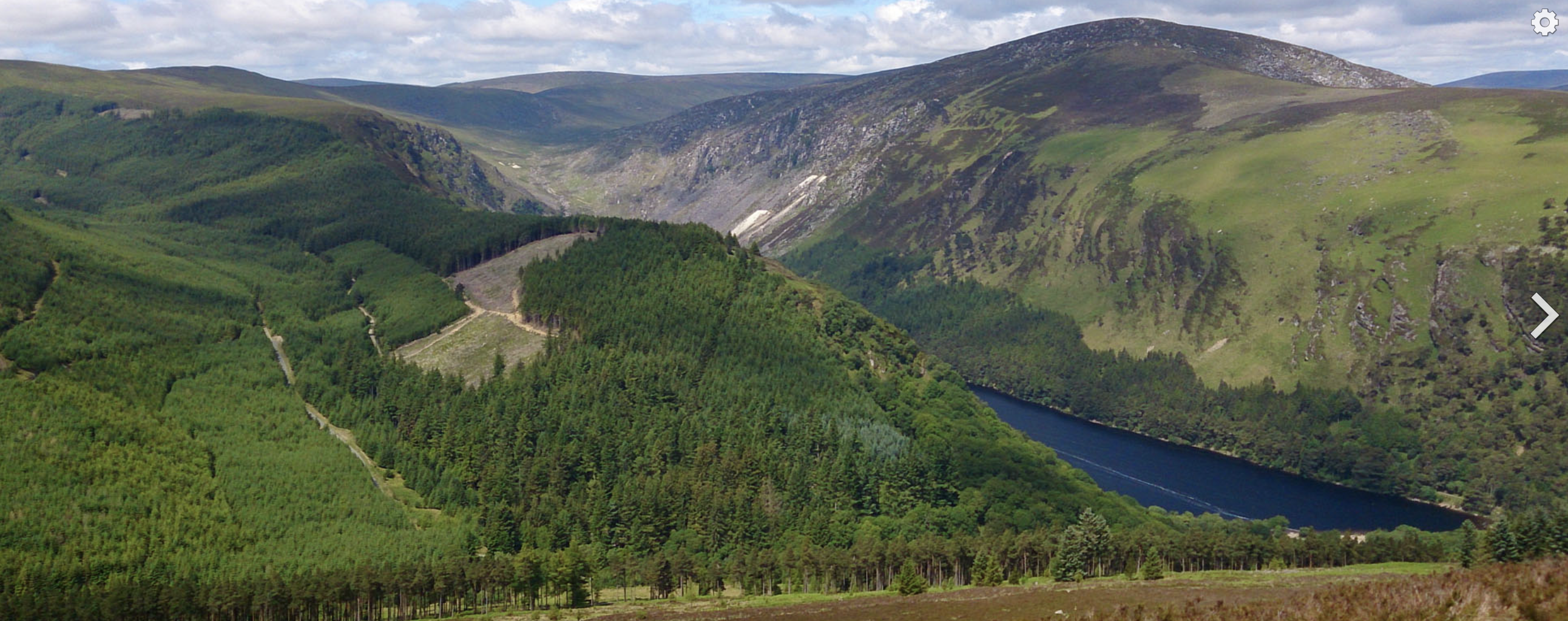
View to Camaderry Mountain, Co. Wicklow.