- This event has passed.
Hill Walk Mourne Wall 1
May 12, 2024
![]()
The Mourne Wall Section 1- From Bloody Bridge to Carrick Little
Walk : Hillwalk following the Mourne Wall from The Bog of Donard to Carrick Little,
Mournes
Meeting Point: 09.45am Carrick Little Binnian Car Park, , 74 Oldtown Road, Newry BT34
4RW, United Kingdom.
Follow this link: https://maps.app.goo.gl/VqdD2cW6WznCuevm8
Grid Ref: J344 OS sheet 29 or Mournes Activity Map
Meeting Time: 09:45 am Carrick Little car park where we leave some cars and drive to the
start of the walk at Bloody Bridge J389 271. Toilet facilities are available at Bloody Bridge.
Walk Start Time: 10:15 am
Route: Our walk on Sunday 12th May is a linear walk which will start at Bloody Bridge Car
Park J389 271 and follow the Bloody Bridge River uphill past the Quarry to meet the Mourne
Wall at the style at The Bog of Donard (climb 500m). The aim is to follow the Mourne Wall
section by section (33.4km total length, Total Ascent 2970m).
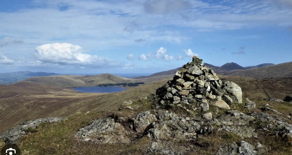
On Sunday 12th May we will follow the wall southwards, across the bog towards Rocky Mountain 525m. This section is
very, very boggy and some people may prefer to walk on top of the Mourne Wall. At Rocky
Mt we turn SE towards Long Seefin 350m, where we take a sharp turn SW making our
descent across some large rocks towards Annalong Woods. The Mourne Wall goes through
private land here so we will follow a track southwards to Head Road where we turn right and
walk back 1.5km along the road to Carrick Little car park. Some cars will then go back to
Bloody Bridge where drivers will collect their cars.
Distance: 12.5 km
Height: Total ascent 650m, Max elevation 530m
Duration: 4.5 – 5 hours
Please Text the leader by Friday 10th May if you intend going on the walk
Leader’s Note: This is moderate hillwalk with most of the climb at the start from sea level at
Bloody Bridge up to The Mourne Wall. Taking about two hours. With good weather we
should get views of the High Mournes to the North and West and across The Irish sea to the
East.
Directions from Skerries: From Skerries get on the M1 via R127 and R122.
Google Map’s route exits A1 motorway to the north of Newry (signs for Newry/A28/Downpatrick/A25) and loops
around the North East of the town before joining the Hilltown Rd/B8. Some sections of this route are narrow and
winding. An alternative would be to exit the A1 at the first/South exit for Newry/A2/Warrenpoint and drive via the
Dublin Rd. towards the town centre. Continue onto Bridge St., William St. and Abbey Way (ignoring the right turn
for Warrenpoint) and turn right at a small roundabout for Hilltown (on to Windsor Hill/B8). Continue on B8
through Mayobridge and Hilltown. At the roundabout downhill from Hilltown, turn right onto Kilkeel Rd./B27.
Continue on the B27 (passing Spelga Dam) for 14km, then turn left onto Head Rd. After 2.6km, turn left to stay on
Head Rd. Pass entrance to Silent Valley Reservoir/Mountain Park. After 4km, turn left just before the “Tea Pot”
sign for the free car park or if it is full Continue for 0.5km to Carrick Little Cafe car park on the left. The café may
be closed at this time of year. Parking fee £3, payable by card or cash. Should this car park be full, parking is
available a short distance further along the Annalong Valley access road/laneway, fee £3.
Google Map directions, enter Carrick Little Slieve Binnian Car Park as destination on your phone.
(Note that phone reception/WiFi may not be available in the Mournes area).
Please check out the Google Maps link for the starting point before the walk day so that any issues can be
resolved. Remember that phone assistance may not be available due to lack of signal while “En Route” to
the Start Point
Walkers need to be able to get to the walk start location independently and on time.
Or follow this link:https://maps.app.goo.gl/VqdD2cW6WznCuevm8
Covid-19 related: Walkers are advised that they will be asked to confirm that they have no
Covid-19 like symptoms and agree to walk at their own risk. The organisers cannot accept any
liability in the event of injury/Covid-19 infection
WhatsApp : for ease of communication a Whats App group will be set up for the group coming
on this walk. If you do not wish to be included please let the leader know when registering your
interest in the walk.
General:
Leave No Trace: the club is a supporter of the Leave No Trace campaign so please ensure
that you leave no litter (of any sort) on the hike route
Clothing/Equipment: please ensure that, at the very least, you have either hiking boots or
walking shoes (no trainers) and depending on weather forecast, multiple layers including a
warm jacket/ fleece, hat and gloves, a waterproof jacket, waterproof trousers, a flask with a
hot drink, food, snacks and water.
If unsure about the required gear or your ability to undertake the walk please check with
the walk leader in advance.