
- This event has passed.
Hill Walk Djouce Mtn. CANCELLED!
February 16, 2020
![]()
THIS WALK HAS BEEN CANCELLED DUE TO FORECASTED ADVERSE WEATHER CONDITIONS.
Meeting Point/s: (1) Skerries Point Eurospar at 8.30 a.m., Depart 8.40 a.m.
(2) Crone Wood Car Park at 9.50 a.m.
Time: 8.30 a.m. Skerries, 9.50 a.m. Crone Wood Car Park
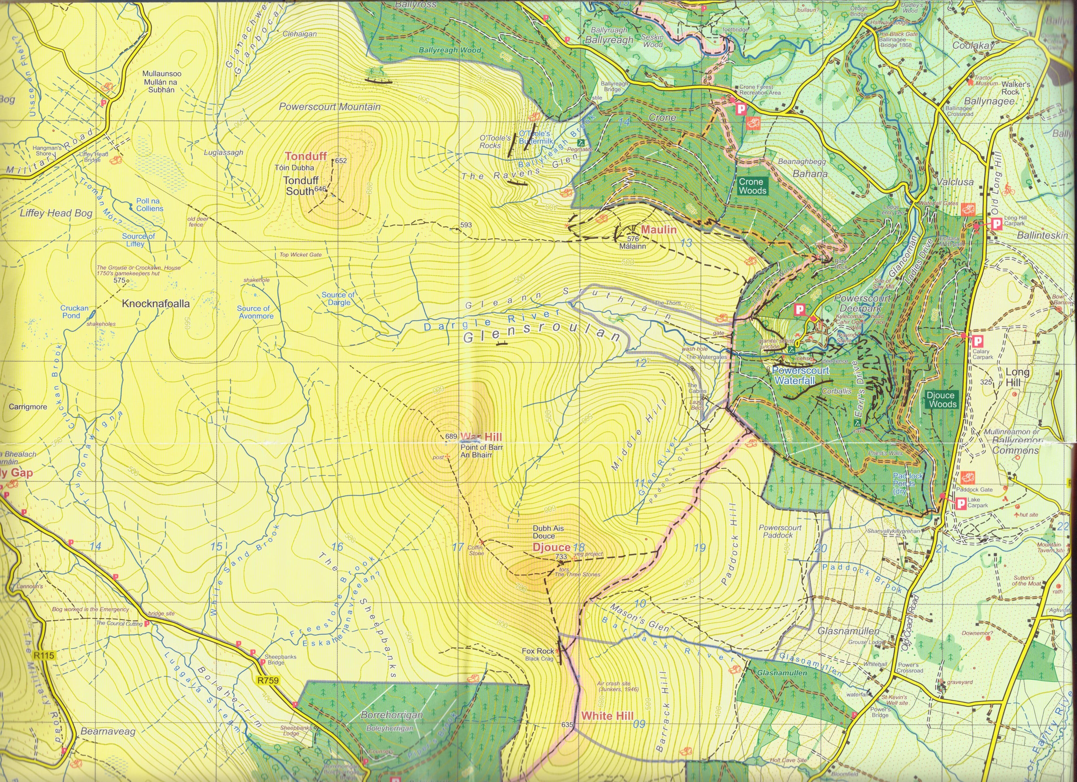
Walk Starting Point: Crone Wood Car Park
Walk Starting Time: 10.00 a.m.
Route: Crone Wood Car Park – Wicklow Way – Djouce Summit – Wicklow Way – Crone Wood Car Park
Distance: 16km
Duration: 5-5.5 hours (moderate pace and includes breaks)
Height: Summit 733mtrs, climb 550mtrs
Leaders: John Coleman & Mary Collins (Mob: 087 – 686 5243; Email: colemanjo@eircom.net)
THIS IS A HILLWALK – NOT A RAMBLE
Leader’s Note:
A good level of fitness is required for this HILLWALK and hiking poles are recommended. We start at Crone Wood Car Park following the Wicklow Way through the forest overlooking the Powerscourt Waterfall and on to the open mountains, following the trail going straight up to the summit of Djouce. The views along the way are stunning – Dublin Bay, Great Sugarloaf, Poolbeg and Howth. Following a stop for lunch at the summit, we will then head down along the Wicklow Way boardwalk and take the same route back to the car park. As the mountain is quite exposed please bring extra layers, Djouce summit is breezy and can be cold.
Please text or email joint leader John Coleman by Saturday 15th Feb. if you intend going on the walk and indicating whether you will be meeting at Skerries or Crone Wood Car Park.
Directions from Skerries:
Take the M1, M50 (to end), M11 and N11 and continue on the N11 and take junction 8 signposted Roundwood / Kilmacanogue (exit immediately after the service station). Note: Loo and sandwiches available in the service station. Crone Wood car park is 6.9km and 12 mins from here.
Go up the slip road and at the roundabout take the 3rd exit taking the bridge back over the motorway, at the small roundabout (at Plucks) turn left onto R755. After approximately 2 kms take a right turn (sign posted ‘Enniskerry’) onto R760. Stay on R760 for approximately 1.4 kms then take a left turn (the main road turns right – keep left – sign posted ‘Powerscourt Waterfall’ and Coolakay House B&B) leaving the R760.
After approximately 1.5 kms (as you go downhill and approach gates to Powerscourt Waterfall) go right. Continue for approx. 2 kms, Crone Wood car park is on the left.
On the way back, we can stop in Plucks, Kilmacanogue for tea/coffee or food if anyone wants to.
CLICK ON +GOOGLE MAPS IN VENUE SECTION BELOW FOR WALK START LOCATION
1) Please ensure that, at the very least, you have hiking boots (no trainers), multiple layers including a warm jacket/fleece, hat and gloves, a waterproof jacket and trousers, a flask with a hot drink, sandwiches/snacks, a litre of water and a small rucksack. If you are unsure about your gear check with leader a few days beforehand as anyone turning up with inadequate gear will not be permitted to walk.
2) It is highly recommended that you do not wear any clothing made from DENIM/CORDUROY/COTTON on the hike.
3) The club is a supporter of the ‘Leave No Trace’ campaign so please ensure that you leave no litter (of any sort) on the hike route.
4) NEVER go ahead of the Leader without being sure of the way!
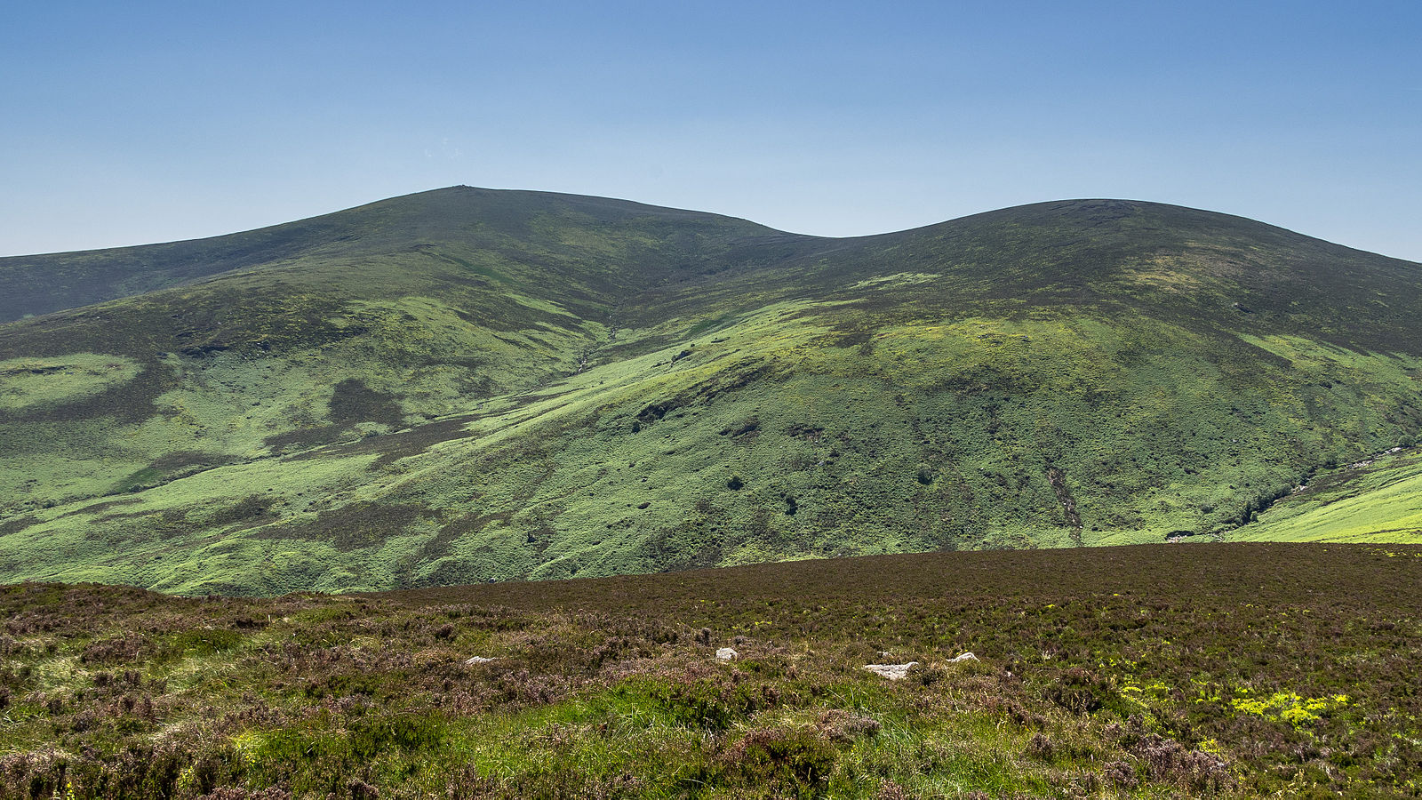
Views to south west taking in War Hill and Djouce.