
- This event has passed.
Hill Walk Tonelagee
April 16, 2023
![]()
Route: Glenmacnass river – Lough Ouler – Tonelagee
Distance / Duration: 8km / 4 hours incl breaks
Total ascent: 490 m
Max Elevation: 817 m
Classification: Moderate (but on the easy side)
Meeting Point: Glenmacnass waterfall car park, on the R115
Walk Start Time: 10:30 am
Leader’s Note:
Tonelagee is the third highest peak in Wicklow. It has a deep corrie that cuts into its flanks, at the base of which lies heart-shaped Lough Ouler. From the car park (358m) we go upstream along the bank of the Glenmacnass river for a short distance and then cross the river via natural stepping stones. We follow the river upstream for about 1km until we reach the outlet stream that flows down from Lough Ouler. We cross this small stream, then turn left and follow along its northern bank, climbing steadily for about 2km up to the lake (566m). On arriving at Lough Ouler we follow a rough track along its northern shore. Then up to a shallow col and from there we make a steep curving ascent around the northwestern rim of the corrie. The summit of Tonelagee (817m) is marked by a triangulation pillar and the views are very good. Looking southwest, one can clearly see Turlough Hill reservoir, with Lugnaquilla in the background, and to the north, Mullaghcleevaun is visible. From the summit we head northeast, keeping close to the rim of the corrie for fine views of the lough below. We descend across a shallow col and climb slightly to ‘Tonelagee NE’ (668m). From here we descend along a long broad spur back down to meet the Glenmacnass river, cross the river using the same stepping stones, and then back to the car park.
The route consists entirely of rough tracks and open mountain terrain. It is a relatively short hillwalk, but the ground is very soft and wet in places, which slows the walking pace. I would highly recommend bringing walking poles (if you use them) and gaiters to help negotiate the stepping stones and the boggy areas.
Directions from Skerries:
Take the M1, M50, then M11 and N11. Exit at junction 8 at Kilmacanogue. Take the R755 to Laragh and then take the R115 (Military road) to Glenmacnass waterfall (about 7km NW of Laragh). The car park (grid ref O113030) is large and on the left-hand side just above the waterfall. Driving time from Skerries to Glenmacnass car park is about 1 hour 30 mins.
Please text Paul Mulligan by Friday 14th April if you would like to go on the walk. Please provide a mobile phone number for contact. For ease of communication and updates a WhatsApp group will be set up for this walk. If you do not wish to be included in this WhatsApp group, then please let the leader know when you get in touch to book your place. Please note the Club does not organise carpooling, however if you wish to request or offer a lift, then please do so on this WhatsApp group.
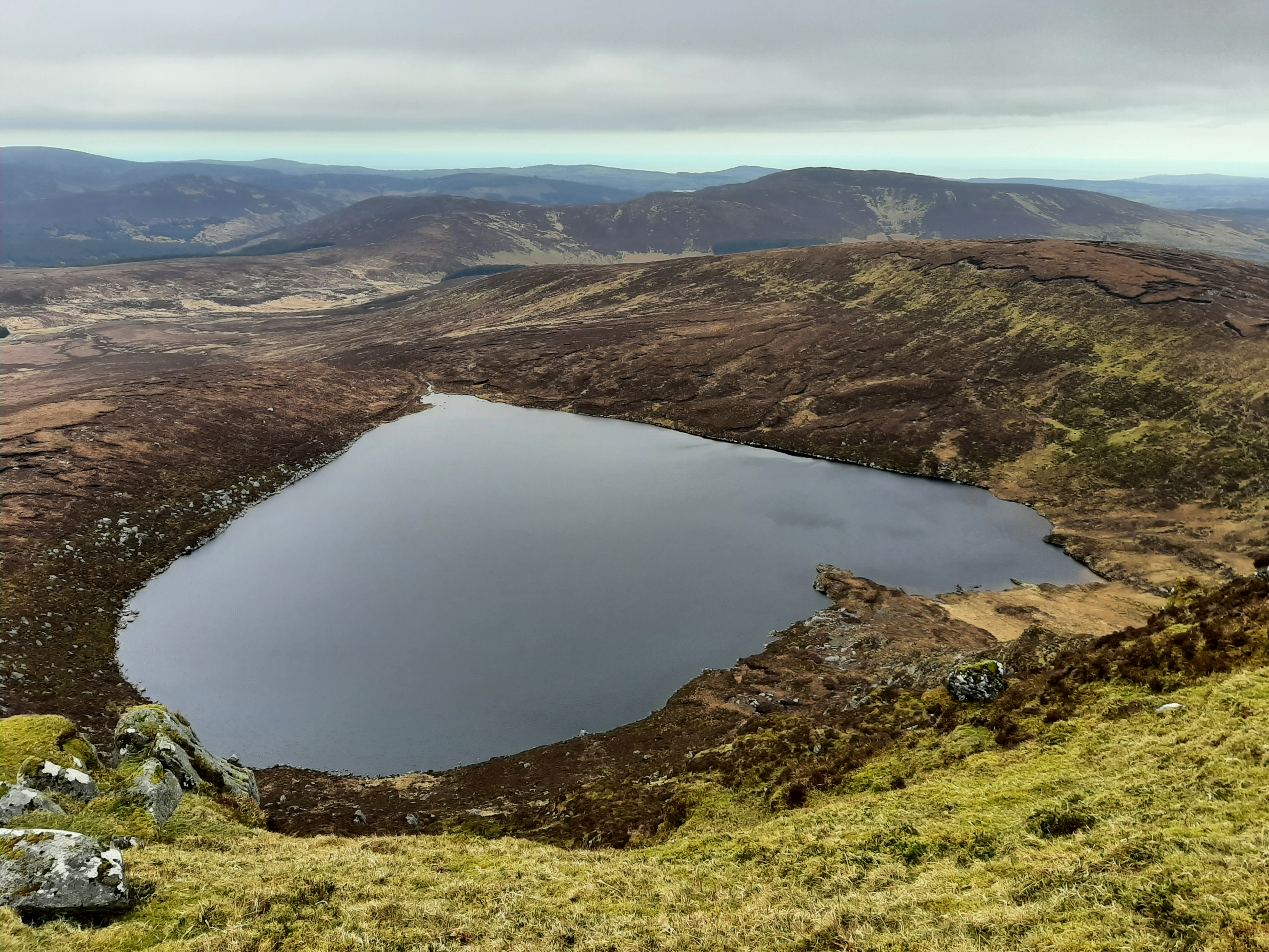
Lough Ouler
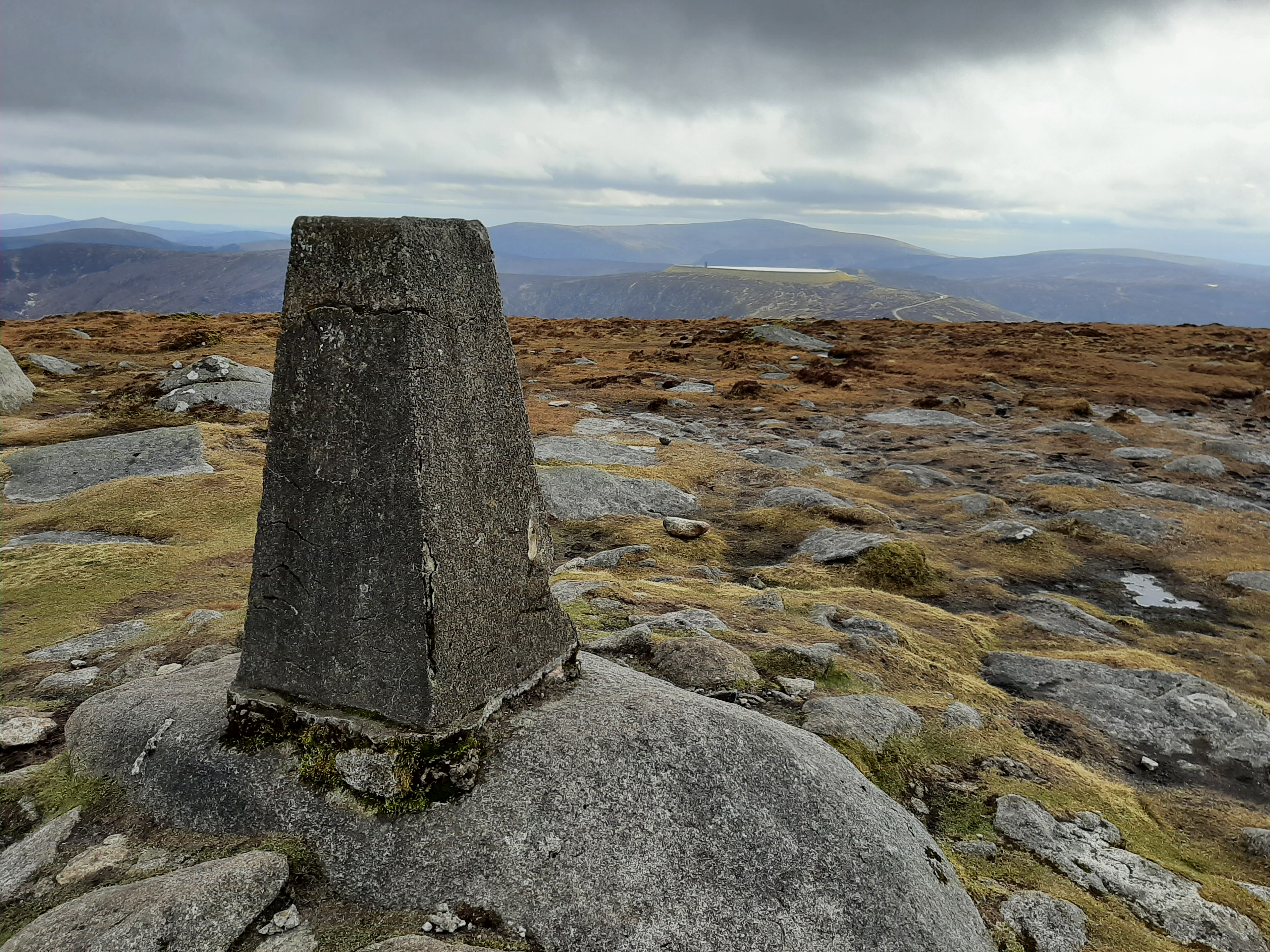
Trig point at the summit of Tonlagee with Turlough Hill and Lugnaquilla in the background